SoCal Forecast
Updated most Sundays, Tuesdays, and Thursdays
Tuesday 6/23/26 6:30 AM
By Nathan Cool
Surf Charts for SoCal
Rincon | Ventura, C-St. | County Line | Malibu | Hermosa | Huntington BeachTrestles | Old Mans | Oceanside | Beacons | Sunset Cliffs
Subscribe to be notified:
Get notified when this report is updated.
At a glance:
Today (Tuesday the 23rd) we have diminishing southern hemisphere ground swell in SoCal. Size picks up Wednesday the 24th as a decent sized SW ground swell comes ashore. Moderate southern hemi and light wind swell are due over the weekend. Light to moderate SW ground swell is due by the middle of next week. Light to moderate southern hemis are being watched for the 2nd through the 6th. Better sized ground swell is being watched for the 7th. Condition-wise: fair weather cools this weekend; winds pick up in a few days; tide levels are moderate; and water temps are fair.
|
|
|
Current Conditions:
Early this morning, periods were primarily running 15 seconds from 200°, although 17-second forerunners were coming in at times from 205° signaling the next swell for SoCal (page 43).
Most south facing spots were running waist to chest high with occasional pluses from the forerunners. Direct west facing breaks were mostly waist high.
Buoys in the outer waters were running 5'. Nearshore buoys were running 2.2-2.8'.
Tide levels are moderate for now. Today we have a 3' high around 6:00 AM, a 1.7' low around 11:00 AM, a 5.2' high around 6:00 PM, and a 0.7' low around 1:00 AM (Wednesday).
Water temps were running 66-68° around most of SD. OC was varied with Huntington Beach reporting 60° yesterday, Newport 63°, and San Clemente Pier 66°. LA was hovering around 64-66° but the usually-cooler Zuma reported 61° yesterday while the often-warmer Hermosa reported 70°. In VC, Channel Islands Harbor reported 62° last night. SB Harbor reported 62° this morning.
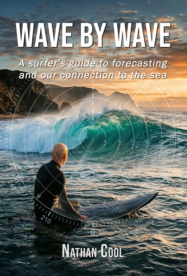
New Release: Wave By Wave
Take a journey into the hidden forces behind every swell and the ocean's connection to our human experience. After more than 30 years of tracking storms across the Pacific, Nathan Cool's latest book, Wave By Wave, takes you beyond basic swell prediction and into the deeper story behind the surf. From distant, powerful storms to the moment a wave breaks, you'll learn how to read the ocean with confidence and discover how these rhythmic forces bind us to the sea with a deeper sense of meaning.
Get the Book
Surf Forecast:
Today (Tuesday the 23rd) the latest southern hemisphere ground swell is on the way out after peaking in SoCal Sunday. But things turn around tomorrow.
Wednesday the 24th should see the next SW ground swell from this system that drifted northward off Antarctica last week (model generated by XyGrib from NFCENS data):

That should produce chest high waves on the average sets at south facing breaks but up to head high at standouts. Swell should be angled from 205° and periods 17-18 seconds. This swell should continue at chest to at times head high Thursday the 25th, and then chest high Friday the 26th.
Saturday the 27th (building day) into Sunday the 28th (peak) should see SW ground swell from this system that passed south of New Zealand about a week ago (model generated by XyGrib from NFCENS data):

That wasn't a great course for SoCal swell. But with 30-35' seas it should produce chest max sets at south facing breaks, angled from 215° and periods 18 seconds. This swell should continue Monday the 29th with similar size.
Saturday the 27th into Sunday the 28th, along with the southern hemi swell we should also see NW wind swell in the mix as this robust trough of low pressure digs south into SoCal (model by NOAA MAG):

This will increase the onshore flow by the weekend along with fairly strong NW winds that will likely gust to around 30 mph in the outer waters. Winds will be lighter along the coast, but stronger than normal (see Wind section below). Those outer water winds are unimpressive for wind swell, but they should gin-up 10' seas west of the Channel Islands, which works out to waist to chest high NW wind swell at west facing breaks by Sunday the 28th, building Saturday the 27th. This will be angled very steep for SoCal at ≥300°, with most of the energy skirting past SoCal (pages 45-49). So all told, most breaks are looking at waist to chest high waves this coming weekend. All of this should fade to around waist high everywhere Monday the 29th.
Tuesday the 30th (building day) into Wednesday the 1st (peak) should see moderately sized southern hemisphere ground swell from these two storms that peaked a couple days ago (model generated by XyGrib from NFCENS data):

ETA into SoCal is the same for both as storm #1, although being farther away, had longer periods than storm #2 (page 41). All told, south facing breaks should see chest high sets by Wednesday the 1st (building Tuesday the 30th) with swell angled from 190-210° and periods 17-18 seconds.
Thursday the 2nd (building day) into Friday the 3rd should see light to moderate SW ground swell from this system hugging the ice pack (model generated by XyGrib from NFCENS data):

Its initial easterly course from that extreme low latitude gets very little improvement once tracking northeastward in a couple days as its seas should be weaker then. This is looking like a waist to chest high swell for south facing breaks by Friday the 3rd, angled from 200° with periods 18 seconds. This swell would continue Saturday the 4th with similar size. A similar but even lower latitude storm running behind it would keep waist to at times chest high waves going at south facing breaks Sunday the 5th and Monday the 6th. That's on the 2-day outlook and I'll confirm it in my Thursday report.
Tuesday the 7th could see better sized SW ground swell from this system on the 6-day models taking a better, wave-worthy course for SoCal swell (model generated by XyGrib from NFCENS data):

This would have much less loss from its angular spread (page 52), so running the numbers this morning works out easily to chest+ waves at south facing breaks with potential for for this being a head high swell. Swell would be angled from 200° with periods 18 seconds. Being out on the 6-day, with a slight departure from earlier models puts some question marks at this point in the forecast, but I'll see how models deal with this over the next couple days and have an update in my Thursday report.
Looking toward the tropics, models have waffled back to a no-go for hurricane swell around the beginning of July. There is cyclonic potential on the models, but none so far that would be strong enough to send waves our way. Still, ensemble models like the GEFS are teeming with an overabundance of tropical storm activity; however, that ensemble is the product of 30 different model members, thus showing an all-case scenario. It is a strong signal for surf potential, but not one that raises confidence enough to entertain swell — for now. Given this and the tropics being a literal hotbed with warmer than normal water temps and a developing El Niño, the eastern tropical Pacific warrants more monitoring. And as long as I have your support then I can continue to keep an eye on the Pacific to track surf-worthy storms to keep you posted. Please remember this report is funded by reader donations and your help is needed to keep this report alive (see why here).
|
|
|
Here's a brief look at how the next few days are breaking down so far:
Wednesday the 24th is expected to run chest to at times head high at south facing spots.
Thursday the 25th looks about chest to at times head high at south facing spots.
Friday the 26th looks about chest high at south facing spots.
Saturday the 27th looks about chest max at south facing breaks and waist to chest at west facing spots.
Sunday the 28th looks about chest max at south- and west-facing breaks.
Monday the 29th looks about waist to times chest at most breaks.
Tuesday the 30th is expected to run chest max at south facing breaks, smaller at west facing spots.
Wednesday the 1st, so far, looks about chest max at south facing breaks.
Thursday the 2nd, so far, looks about waist to chest high at south facing breaks.
Friday the 3rd, so far, looks about waist to chest at south facing breaks.
Saturday the 4th, so far, looks about waist to at times chest high at south facing breaks.
Sunday the 5th, so far, looks about waist high at south facing breaks with occasional chest high pluses.
Monday the 6th, so far, looks about waist to at times chest high at south facing breaks.
Tuesday the 7th, so far, is looking at chest+ ground swell at south facing breaks.
Wednesday the 8th, so far, is looking at chest+ ground swell at south facing breaks.
Weather Outlook:
Today (Tuesday the 23rd) a large area of high pressure is centered over western Texas spreading well into SoCal. This high will move west into AZ/NM later today as it teases the heat-wave signaling 600dm mark. This high warmed desert areas yesterday with Palm Springs seeing temps over 100° until almost 8:00 PM last night. This created a hefty thermal inversion this morning (pages 131-134) adding a thickening agent to a coastal eddy that kicked up last night (page 135). That eddy was still visibly swirling at 8:00 AM this morning with outer water winds gusting to near 15 mph north of LA and 15 mph south of LA — a textbook eddy spin centered around LA.
High pressure should slowly drift to the southwest Wednesday the 24th as it weakens slightly. The bigger change starts Thursday the 25th when the high weakens further and eventually gets supplanted by the trough of low pressure responsible for wind swell this coming weekend, shown here again to save you from scrolling (model by NOAA MAG):
NW winds along the coast will be stronger this weekend and cooler air will be injected into the upper and lower levels, keeping the inversion in lockstep at upper and lower levels. So no matter how you slice it, the coast is looking at morning marine layer each day in the forecast but with some day-to-day deviations.
Once that trough passes Monday the 29th another should take its place, resulting in a troughing pattern through most of next week. The troughing pattern will likely lift Monday the 6th, but with no major high pressure taking its place. This should sustain June Gloom into the holiday weekend — by the looks of things right now.
One other weather feature worth mentioning is precip from tropical moisture Wednesday the 24th that, while being isolated to the mountains, is showing up on models near parts of the OC and SD coast. The chances of precip are super small, but thought I'd mention it.
Taking all of this into account, here's how I'm calling SoCal beach weather for the next few days:
Today (Tuesday the 23rd) should see a burn-off late morning but with a few pockets lingering until early afternoon. Max beach temps should reach 70°.
Wednesday the 24th should see AM marine layer with a burn-off mid to late morning and max beach temps around 70°.
Thursday the 25th should see AM marine layer with a burn-off by late morning and max beach temps around 70°.
Friday the 26th should see AM marine layer with a burn-off by noon and max beach temps in the upper 60s.
Saturday the 27th should see AM marine layer with a burn-off late morning, but possibly not until early to mid afternoon south of LA, more so around SD. Max beach temps should reach the mid to upper 60s.
Sunday the 28th should see AM marine layer dissipate by late morning north of LA, lingering into early afternoon from LA south. Max beach temps should reach the mid to upper 60s.
Wind Outlook:
Winds
at 6:00 AM were light and variable most everywhere with a slight southerly element. Afternoon onshores should reach 10-15 mph.
Wednesday the 24th should see AM light and variables with a slight onshore element and afternoon onshores to 15 mph.
Thursday the 25th should see AM light and variables with a slight onshore element and afternoon onshores to 15 mph.
Friday the 26th should see AM light and variables with a slight southerly element and afternoon onshores 14-18 mph.
Saturday the 27th, so far, is expected to see AM light and variables with a southerly element, picking up onshore by noon 10-15 mph, and then 20 mph with gusts to 25 mph by mid afternoon.
Sunday the 28th, so far, is expected to see AM light and variables with a more pronounced southerly element, picking up onshore by noon 10-15 mph, and 15-20 mph during the afternoon.
Until my next report (Thursday), take care, be safe, and smile in the lineup!