SoCal Forecast
Updated most Sundays, Tuesdays, and Thursdays
Thursday 10/22/26 5:55 AM
By Nathan Cool
Surf Charts for SoCal
Rincon | Ventura, C-St. | County Line | Malibu | Hermosa | Huntington BeachTrestles | Old Mans | Oceanside | Beacons | Sunset Cliffs
Subscribe to be notified:
Get notified when this report is updated.
At a glance:
Today (Thursday the 22nd) we have fading SW and NW ground swells in SoCal. Light to moderate southern hemi is due Friday the 23rd into Saturday the 24th. A series of SW ground swells are due during the second half of next week. Somewhat bigger SW ground swell is due over the weekend of the 31st-1st. Strong wind swell may follow. And NW ground swell is being watched for the 3rd. Condition-wise: clearer weather ahead with moderate winds; tide levels are running deep; water temps remain above normal; and advisories are in effect.
|
|
|
Current Conditions:
Early this morning, periods were primarily running 13-14 seconds from 180-190° and 12 seconds from 280-300°.
Most south facing breaks were running chest to head high. West facing spots were mostly chest high, bigger at SW exposed spots.
Buoys in the outer waters were running 6'. Nearshore buoys were averaging 3.5'.
Water temps were running 72-75° around most of SD and OC. LA was hovering around 70°. In VC, Channel Islands Harbor reported 70° last night. In SB, Stearns Wharf reported 70° this morning.
Tidal Advisory: Water levels are running about 16" above normal as the Marine Heat Wave continues off Baja and SoCal. The tide tables don't account for the above normal water levels so those predictions need another 16" added to them to represent accurate levels. For instance, today's 5' high around 8:00 AM will actually be about 6.5'. These high tides will deepen further as we approach a Full Moon Sunday the 25th. The weekend "predicted" high tides will be over 6', which will actually be closer to 8'.
Water Contact Advisory: Rain has increased the risk of contamination from runoff in the surf zone. As a reminder, there is a risk of high bacteria levels for at least 72 hours following any measurable rain event (usually 0.1" or more) during which time water contact should be avoided.
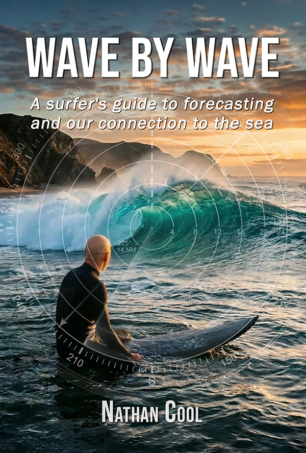
New Release: Wave By Wave
Take a journey into the hidden forces behind every swell and the ocean's connection to our human experience. After more than 30 years of tracking storms across the Pacific, Nathan Cool's latest book, Wave By Wave, takes you beyond basic swell prediction and into the deeper story behind the surf. From distant, powerful storms to the moment a wave breaks, you'll learn how to read the ocean with confidence and discover how these rhythmic forces bind us to the sea with a deeper sense of meaning.
Get the Book
Surf Forecast:
Today (Thursday the 22nd) SW swell is fading from the southern hemi that peaked a couple days ago, and NW swell is fading from the storm-related fetch that recently slid down the coast.
Friday the 23rd, as the NW swell fades further, we should see SW ground swell from this low latitude southern hemi (model generated by XyGrib from NCEP data):

This should put most south facing breaks into waist to chest high waves Friday the 23rd and Saturday the 24th with swell angled from 195° and periods 17 seconds. West facing breaks look smaller, about waist high Friday and Saturday.
Sunday the 25th sees the southern hemi back down to about waist high at south facing breaks, smaller at west facing spots. Smaller surf is expected everywhere Monday the 26th and Tuesday the 27th.
Wednesday the 28th and Thursday the 29th should see initially light to moderate SW ground swell from this activity that was hugging the ice cap (model generated by XyGrib from NCEP data):

That should produce initially waist high waves at south facing breaks Wednesday the 28th and then waist to chest Thursday the 29th with swell angled from 205-210° with periods 16 seconds.
Thursday the 29th, along with the southern hemisphere swell, we should also see light NW ground swell from this system near Kamchatka (model generated by XyGrib from NCEP data):

That should produce waist to at times chest high waves at west facing breaks, angled from 310° and periods 15 seconds.
Friday the 30th into Saturday the 31st should see a slight boost at south facing breaks as swell comes ashore from these two systems drifting north off Antarctica (model generated by XyGrib from NCEP data):

That should put south facing breaks into more consistent chest high sets Friday the 30th and then chest+ Saturday the 31st. Swell should be angled from 195-200° and periods 16 seconds.
Friday the 30th into Saturday the 31st may also see swell from Vance, shown here on the 6-day outlook (model generated by XyGrib from NCEP data):

Although housing at least 35' seas, Vance is expected to stay east of our swell window (green line). We'd get a small amount of energy wrapping into SoCal, which works out to about chest high at south facing breaks. The angle would likely read 160-170° on the buoys, although the origin angle would be a steep 145-150°. Periods would run about 14 seconds. Since we have similarly sized swell from the southern hemisphere on the 30th-31st, Vance's swell may go unnoticed. Still, this is out on the 6-day and needs more monitoring.
Saturday the 31st (building day) into Sunday the 1st (peak) should see another boost in SW ground swell from this system taking an ideal northerly course, directing swell toward SoCal (model generated by XyGrib from NCEP data):

That's 24 hours out, but all models are aligned on this bringing chest to head high sets to south facing breaks by Sunday the 1st, angled from 205° and periods 16-17 seconds. This swell will likely linger for a few days as trailing activity behind that system should keep south facing breaks in at least chest high sets Monday the 2nd and Tuesday the 3rd; however, there is a possible snag around that time.
Monday the 2nd might see WSW wind swell as the 10-day models show this low pressure system taking aim at either SoCal or Northern Baja (model by NOAA MAG):

That smacks of not just wind, but also rain. It's far too early to call that now, especially since it's a cut-off low and 10 days out. I'll see how this develops in the coming days.
Tuesday the 3rd is the last swell on my charts this morning from this strong yet distant storm off Kamchatka (model generated by XyGrib from NCEP data):

Based on the 7-day models, that'd produce chest+ sets at west facing breaks, angled from 310° and periods 18 seconds. This needs more monitoring, but as long as I have your support then I can continue to watch the Pacific to keep you posted. Please remember this report is funded by reader donations and your help is vital to keep it alive (see why here).
|
|
|
Here's a brief look at how the next few days are breaking down so far:
Friday the 23rd looks about waist to chest at most breaks.
Saturday the 24th looks about waist to chest at most breaks.
Sunday the 25th looks about waist high at most breaks.
Monday the 26th looks about waist high at most breaks.
Tuesday the 27th looks about waist high at most breaks.
Wednesday the 28th looks about waist to chest at south facing breaks, smaller at west facing spots.
Thursday the 29th looks about waist to chest at most breaks.
Friday the 30th, so far, looks about chest high at south facing breaks and waist to chest at west facing spots.
Saturday the 31st, so far, looks about chest+ at south facing breaks.
Sunday the 1st, so far, looks about chest to head high at south facing spots.
Monday the 2nd, so far, looks about chest to head high at south facing breaks, although there is a chance for WSW wind swell around this time. I'll have more on that in my next report.
Weather Outlook:
Today (Thursday the 22nd) showers will linger off and on in SoCal, mostly from wrap-around moisture as the storm's low has moved inland. Some wrap-around showers may linger in SD Friday morning as another low dives south along the coast. This second low will delay high pressure building back into the region, but we should see mild weather over the weekend with a light offshore effect developing Sunday the 25th into Monday the 26th with the LAX-DAG gradients (page 129) keeping this mild at -1.5mb max Monday.
A low passes to the north by Wednesday the 28th, which should increase the onshore flow slightly in SoCal for the second half of next week. The bigger question is that wind-swell-making low that might bring rain to SoCal by Monday the 2nd, shown here again to save you from scrolling (model by NOAA MAG):
I wouldn't put much stock in that right now as it's a cut-off low on the extended long range models. But I'll keep an eye on it and let you know if anything comes of it.
Taking all of this into account, here's how I'm calling SoCal beach weather for the next few days:
Today (Thursday the 22nd) should see scattered, off and on pop-up showers. Max beach temps should reach the upper 60s.
Friday the 23rd should see spotty AM marine layer and some lingering showers in SD, but skies should begin to clear as the day progresses. Max beach temps should reach the upper 60s.
Saturday the 24th should see a thin marine layer with quick AM burn-off and max beach temps in the low 70s.
Sunday the 25th should see a thin marine layer with quick AM burn-off and max beach temps in the mid 70s.
Monday the 26th should see a thin marine layer with quick AM burn-off, some high clouds at times. and max beach temps in the mid 70s.
Tuesday the 27th should see a thin marine layer with quick AM burn-off and max beach temps in the mid 70s.
Wind Outlook:
Winds
at 6:00 AM were light and variable most everywhere with a SE and SW element. Winds should turn westerly this afternoon 8-12 mph.
Friday the 23rd should see AM light and variables and afternoon onshores 10-15 mph.
Saturday the 24th should see AM light and variables, and afternoon onshores 10-15 mph.
Sunday the 25th should see AM offshores 5-10 mph and afternoon onshores 10-15 mph.
Monday the 26th should see AM offshores 5-10 mph and afternoon onshores 10-15 mph.
Until my next report (Sunday), take care, be safe, and smile in the lineup!